Subsurface Utility Engineering Services
Utility damage prevention has typically involved contacting “811 Call before your Dig” one-call and locating services for public property and relying on eyewitness accounts for private property utility location.
With 811, you are at the mercy of the weather and scheduling and they are not able to reliably locate utilities on private property and with the aging of the baby boomer generation, we are seeing the retirement of many of the individuals with firsthand knowledge of private utility locations.

Subsurface utility engineering, or SUE, is providing infrastructure designers and contractors a more reliable option for utility location information during design and construction. Integration of SUE services helps prevent utility damages and injuries, allowing projects to stay on schedule and budget while protecting the safety of workers and the public. SUE data is good insurance. While the data may only confirm what’s already known about a site, it also could be the most valuable, cost-effective, and accurate method to make sure your future project is built safe, accurately, on time, and within budget.
Wolverine provides reliable and cost-effective Subsurface Utility Engineering (SUE) solutions for the most challenging projects. We can economically mobilize our crews throughout the Mid-west and perform our services quickly and efficiently. We pride ourselves in rapidly delivering accurate results to minimize your project and personnel risk and prevent costly project damages, injuries, and delays.
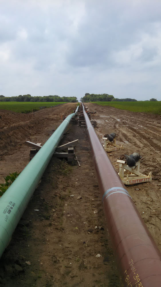
Wolverine has extensive experience performing complex SUE investigations for project of all types and sizes from schools to multi-state pipelines involving design, excavations, horizontal directional drilling, utility maintenance, unexploded ordinance, forensic engineering, and risk management.
What Kind of SUE Investigation Do I Need?
The American Society of Civil Engineers (ASCE) has developed an important standard of care guideline which breaks up SUE investigations into four quality levels of utility depiction:
Quality Level D – Information derived from existing records or oral recollections. This would include historical plan research, aerial imagery, etc.
Quality Level C – Information obtained by surveying and plotting visible above-ground utility features and by using professional judgment in correlating this information to Quality Level D.
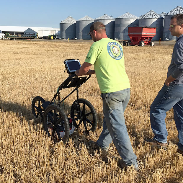
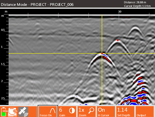
Quality Level B – Information obtained through the application of appropriate surface geophysical methods (i.e. ground penetrating radar, radiodetection) to determine the existence and approximate horizontal position of subsurface utilities. This information is correlated with Levels C and D.
Quality Level A – Precise horizontal and vertical location of utilities obtained by the actual exposure and subsequent measurement of subsurface utilities, usually at a specific point with soft digs (i.e. hand dig, air knife).
End Product- This information is compiled and drafted into an as-built plan that can be used by many different construction disciplines for planning and maintenance.